Connecting Property Records to 25 Years of City Council History
Connected 25 years of City Council records directly to individual properties, transforming fragmented information into a searchable GIS-linked system.
Reduced research time from hours of manual searching to instant property-level access.
The Problem
Staff and residents had to manually search years of meeting records — some digital, many handwritten — to trace zoning history. The process was slow, inconsistent, and difficult to maintain.
What was done
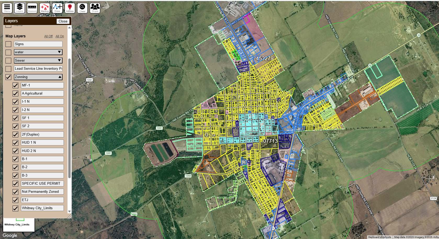
A System That Links Every Parcel to Its Council History
GIS parcel data was connected to 25 years of City Council records, directly linking individual properties to zoning decisions and historical notes. Users can now access zoning history instantly from the map interface instead of searching through separate records. The full city — including parcels and zoning classifications — is organized into a single searchable system with filterable map layers.
GIS map interface zoning overview
How it works
Four Stages From Raw Records to a Usable System
Step 1
Data Collection
GIS parcel data gathered and imported into a mapping system.
Step 2
Records Processing
Digital files converted to searchable formats; handwritten records digitized.
Step 3
Data Structuring
Council actions cross-referenced and linked to individual properties.
Step 4
System Integration
Property-level notes built directly into the map interface.
Selecting a property displays its linked council history instantly, eliminating manual searches and disconnected records.
the system in action
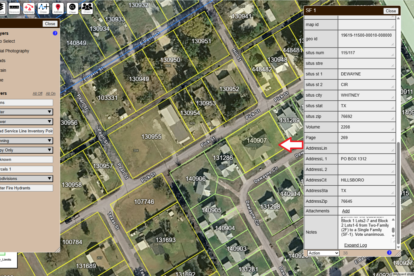
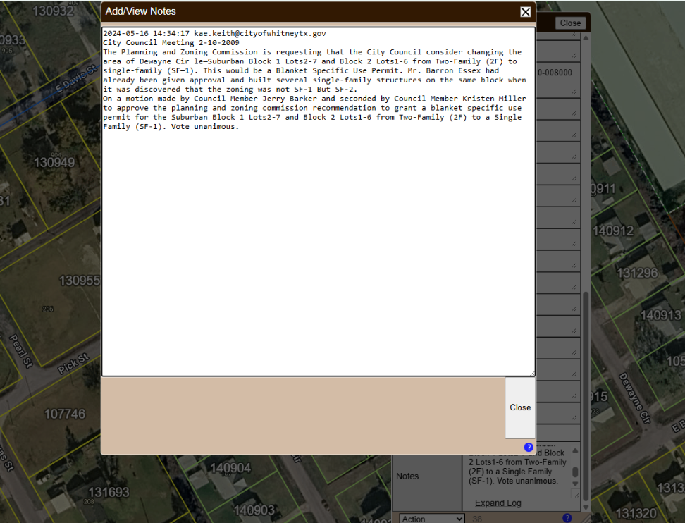
From Parcel Click to Council Decision in Seconds
Parcel details panel — address, geo ID, and linked council notes
Expanded log—complete City Council decision text, dated and attributed
Information that once required extensive manual research became accessible directly from the property map interface.
Before and After
What Changed When the System Went Live
Records Consolidated
Property-Level Linking
Searchable History
Instant Access
Result
A GIS-linked records system that transformed 25 years of fragmented zoning history into searchable property-level information, reducing research time and improving public access to historical records.